Ajman University participates in the 8th International Conference on the Geology in Cairo
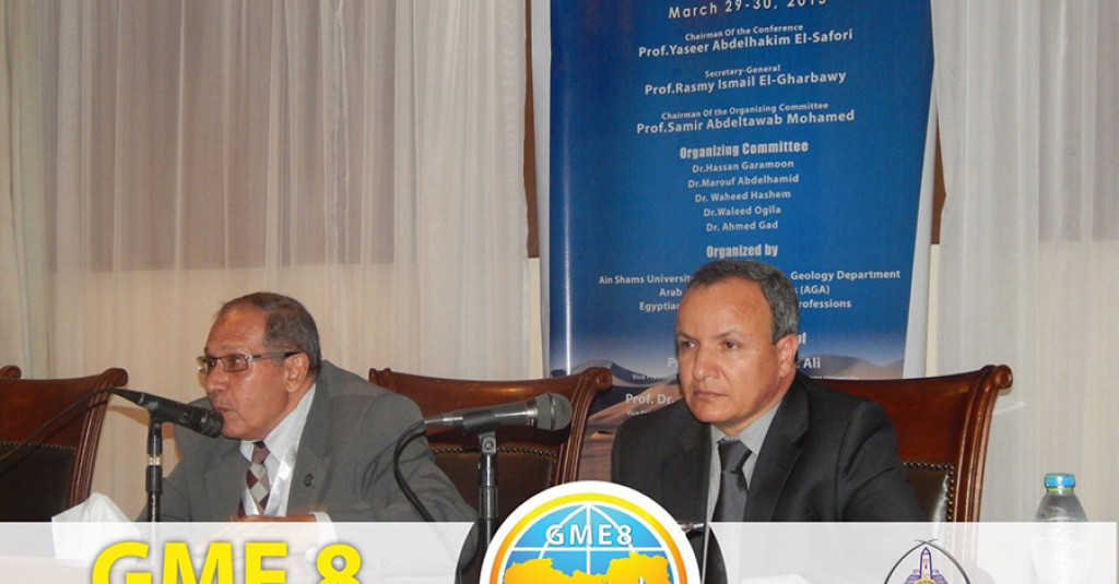
Ajman University of Science & Technology has participated in the 8th International Conference on the Geology of the Middle East, organized by the Ain Shams University in Cairo, during the period 29-30 March 2015, with two scientific papers entitled:
1. Impact of a paleochannel on hydrogeochemistry of a Quaternary aquifer: case study form Umm Al Quwain area in the United Arab Emirates
2. Water chemistry and isotope hydrology of Wadi Al Wurrayah and Wadi Al Tawiyean basins in northeastern United Arab Emirates
The two research papers were presented in Hall B by Prof. Zeinelabidin Rizk, Dean of the Institute of Environment, Water and Energy at Ajman University of Science and Technology between 10:20 and 11:00 am. Prof. Rizk also co-chaired the “Hydrogeology” session between 12:15 and 14:35 pm in Hall A.
Prof. Rizk’s first scientific paper investigated the influence of Wadi Lamhah paleochannel on hydrogeochemistry and groundwater quality in the Quaternary aquifer at Umm Al Quwain area in the United Arab Emirates (UAE).
He addressed the influence of paleochannels of groundwater chemistry and quality in several areas around the world and gave specific examples from the UAE and Egypt. Prof. Zeinelabidin described the field work, laboratory analyses of water samples and office activities. Then, he discussed in details the influence of Wadi Lamhah paleochannel on groundwater temperature and salinity, groundwater chemistry and quality, water dissolved salts and sodium adsorption ratio (SAR); a property determines the suitability of groundwater for irrigation.
At the end of his first presentation, Prof. Rizk summarized the main conclusions of his study in the following main points:
1. Groundwater in the Wadi Lamhah paleochannel has relatively better quality than surrounding areas. The Quaternary alluvial aquifer along the channel has high hydraulic conductivity, short water residence time and high potentiality.
2. The groundwater temperature in Wadi Lamhah paleochannel-affected wells is 4 to 5°C less than the groundwater temperature in rest of the study area.
3. The average groundwater salinity in the paleochannel-affected wells (3,219 mg/L) is less than the average groundwater salinity in rest of the study area (3,791 mg/L).
4. Except bicarbonate ion (HCO3-), average concentrations of cations and anions in the paleochannel-controlled wells are lower than their average concentrations in all wells within the study area.
5. Average nitrate ion (NO3-) concentration in the paleochannel wells (3.5 mg/L) is close to average NO3- level in the study area (3.6 mg/L), because of intensive agricultural activities along the course of Wadi Lamhah paleochannel.
6. Water wells affected by Wadi Lamhah paleochannel have higher percentages of Ca(HCO3)2 and Mg(HCO3)2, MgSO4 and MgCl2 and low percentage in NaCl than the rest of the study area.
7. Groundwater is brackish and moderately hard in water wells affected by Wadi Lamhah paleochannel, and the SAR values are less than 12 for groundwater samples collected from water wells along Wadi Lamhah channel, indicating the suitability of groundwater in these areas for irrigation of palm trees and salt-tolerant crops.
Prof. Rizk’s second research paper analyzed water chemistry and isotope hydrology of Wadi Al Wurrayah and Wadi Al Tawiyean basins and assessed the contribution of their dam reservoirs to groundwater recharge.
Prof. Zeinelabidin explained the general setting of each basin and described in details the field work, chemical analysis of groundwater samples in the UAE and isotope analysis of selected surface and groundwater samples in the Central Laboratories of the International Atomic Energy Agency (IAEA) in Vienna, Switzerland. Prof. Rizk also discussed the results of geophysical investigations, analysis of groundwater chemistry and analysis of stable and radioisotopes isotopes.
At the end of his second presentation, Prof. Rizk, summarized the main findings of this study in the following main statements:
1. The interpretation of four two-dimensional (2D) earth resistivity profiles conducted in Wadi Al Wurrayah basin indicates the presence a fresh alluvial Quaternary aquifer varying in thickness from less than 50 m in the west to more than 100 m in the east. The upper 30 m of this aquifer is dry and the lower portion is saturated with slightly fresh groundwater. This aquifer overlies a strongly fractured ophiolite aquifer, which is saturated with slightly brackish to fresh water in these areas. Three (2D) profiles and eleven vertical electrical sounding (VES) were collected from Wadi Al Tawiyean basin. The correlation of the VES data with the boreholes information indicated the presence of a fresh, shallow Quaternary alluvial aquifer, overlying a brackish massive and fractured limestone aquifer.
2. The mean total dissolved solids (TDS) of surface water in Al Wurrayah dam reservoir was 119 mg/L, while the groundwater salinity increased with increasing distance from the dam. The slight difference in concentrations calcium (Ca2+) and magnesium (Mg2+) ions between Al Wurrayah dam reservoir water and groundwater can be explained by a cation-exchange with the clay minerals present in the Quaternary alluvial aquifer. The average TDS of Al Tawiyean dam reservoir water was 253 mg/L, whereas the salinity of groundwater in the shallow aquifer ranged from 222 to 1,044 mg/L. The groundwater salinity increases with increasing distance from the dam reservoir.
3. The 2H-18O diagram shows that about 80% of samples fall between the global meteoric water line (GMWL) and the eastern Mediterranean water line (EMWL). The rest of samples reflect the evaporation effect. The local meteoric water line for the UAE agrees with that of northern Oman Mountains (2H=818O+16), on a basis of rainfall data >20 mm. Stable isotope data indicates that the groundwater in Al Wurrayah and Al Tawiyean basins is mostly recharged from the dam reservoirs. Mass balance of the stable isotopes for Wadi Al Wurrayah water shows that the contribution dam reservoir water to aquifer recharge varies between 22% and 43%. This high recharge rate may be explained by the hydrogeologic conditions prevailing in the study areas. Where both areas have the highest average rainfall in the country. The aquifers are composed of unconsolidated sand and gravel, fractured of igneous and metamorphic rocks and karstic limestone. These rock types enhance groundwater movement form dam reservoirs into groundwater. The presence of tritium (3H) in all groundwater samples in Wadi Al Tawiyean basin proves that the groundwater in the shallow, alluvial Quaternary aquifer is less than 50 years.